Cave

A cave is a natural underground void large enough for a human to enter. Some people suggest that the term 'cave' should only apply to cavities that have some part which does not receive daylight; however, in popular usage, the term includes smaller spaces like sea caves, rock shelters and grottos.
Speleology is the science of exploration and study of all aspects of caves. Exploring a cave for recreation or science may be called "caving", "potholing", or occasionally (only in the United States) "spelunking".
| |
Types and formation
Caves are formed by geologic processes. These may involve a combination of chemical processes, erosion from water, tectonic forces, microorganisms, pressure and atmospheric influences. Most caves are formed in limestone by solution (see below).
Primary caves

Some caves are formed at the same time as the surrounding rock. These are called primary caves.
- Lava tubes are formed through volcanic activity. They are the most common primary caves. Lava flows downhill and the surface cools and solidifies. The lava now flows under this crust, until the eruption ends. If the liquid lava inside the crust flows out, a hollow tube remains.
Numerous lava tubes are found on Hawaii (Big Island). Kazumura Cave near Hilo is the longest and deepest lava tube of the world and also the eighth longest cave of the United States. It is 65.6km long.
- Blister caves are also formed through volcanic activity.

Secondary caves
Secondary caves are formed inside the rock after the rock itself has formed by processes such as solution and erosion.
- Sea caves are found along coasts around the world. A special case is littoral caves, which are formed by wave action in zones of weakness in sea cliffs. Often these weaknesses are faults, but they may also be dykes or bedding-plane contacts. Some wave-cut caves are now above sea level because of later uplift. Elsewhere, in places like Thailand's Phang Nga Bay, solutional caves have been flooded by the sea and are now subject to littoral erosion. Sea caves are generally around 5–50m in length but may exceed 300m.

- Glacier caves occur in ice and under glaciers, formed by melting. They are also influenced by the very slow flow of the ice which tends to close the caves again. (These are sometimes called ice caves, though this term is properly reserved for caves which contain year-round ice formations).
- Solutional caves may form anywhere with rock which is soluble, and are most prevalent in limestone, but can also form in other material, including chalk, dolomite, marble, granite, salt, sandstone, fossilized coral and gypsum. The most common process of cave formation is karstification, which is the solution of rocks by rain water.
- Fracture caves are formed when layers of more soluble minerals such as gypsum dissolve out from between layers of less soluble rock. These rocks fracture and collapse in blocks.
- Talus caves are the openings between rocks that have fallen down into a pile, often at the bases of cliffs.

- Anchihaline caves are caves, usually coastal, containing a mixture of freshwater and saline water (usually sea water). They occur in many parts of the world, and often contain highly specialized and endemic faunas.
The largest and most abundant solutional caves are located in limestone. Limestone dissolves under the action of rainwater and groundwater charged with H2CO3 (carbonic acid) and naturally occurring organic acids. The dissolution process produces a distinctive landform known as karst, characterized by sinkholes, sinking streams, and underground drainage. Limestone caves are often adorned with calcium carbonate formations produced through slow precipitation, including the most common and well-known stalactites and stalagmites. These secondary mineral deposits in caves are called speleothems. The world's most spectacularly decorated cave is generally regarded to be Lechuguilla Cave (New Mexico, USA).
Lechuguilla and nearby Carlsbad Caverns are now believed to be examples of another type of solutional cave. They were formed by acid rising from below, where reservoirs of oil give off sulfurous fumes, rather than by acidic water percolating from the surface.
Distribution and Records
Caves are found throughout the world, but only a portion of them have been explored and documented by cavers. The distribution of documented cave systems is widely skewed toward countries where caving has been popular for many years (such as France, Italy, Australia, the UK, the United States, etc.). As a result, explored caves are found widely in Europe, Asia, North America, and Oceania but are sparse in South America, Africa, and Antarctica. This is a great generalization, as large expanses of North America and Asia contain no documented caves, whereas areas such as the Madagascar dry deciduous forests and parts of Brazil contain many documented caves. As the world’s expanses of soluble bedrock are researched by cavers, the distribution of documented caves is likely to shift. For example China, despite containing around half the world's exposed limestone - more than 1,000,000 km² - has relatively few documented caves.

The system with the greatest total length of passage is Mammoth Cave (Kentucky, USA) at 579 km in length. This record is unlikely to be surpassed in the near future as the next most extensive known cave is the Optymistychna system in Ukraine, at 214 km.
As of 2005, the deepest known cave (measured from its highest entrance to its lowest point) is Voronya Cave (Abkhazia, Georgia), with a depth of 2,140 m. This was the first cave to be explored to a depth of more than 2 km. (The first cave to be descended below 1 km was the famous Gouffre Berger in France). The Gouffre Mirolda - Lucien Bouclier cave in France (1733 m) and the Lamprechtsofen Vogelschacht Weg Schacht in Austria (1632 m) are the current second and third deepest caves. This particular record has changed several times in recent years.
The deepest individual pitch (vertical drop) within a cave is 603 m in the Vrtoglavica cave in Slovenia, followed by Patkov Gušt (553 m) in the Velebit mountain, Croatia.
The largest individual cavern ever discovered is the Sarawak Chamber, in the Gunung Mulu National Park (Sarawak, Borneo, Malaysia), a sloping, boulder strewn chamber with an area of approximately 600 m by 400 m and a height of 80 m.
Since new caves are continually being explored, the various records of cave dimensions need to be updated fairly frequently.
For information on a specific cave, see list of caves.
Inhabitants

Cave-inhabiting animals are often categorized as troglobites (cave-limited species), troglophiles (species which can live their entire lives in caves, but also occur in other environments), trogloxenes (species which use caves, but cannot complete their life cycle wholly in caves) and accidentals (animals not in one of the previous categories). Some authors use separate terminology for aquatic forms (e.g., stygobites, stygophiles, and stygoxenes).
Of these animals, the troglobites are perhaps the most unusual organisms. Troglobitic species often show a number of characteristics, termed troglomorphies, associated with their adaptation to subterranean life. These characteristics may include a loss of pigment (often resulting in a pale or white coloration), a loss of eyes (or at least of optical functionality), an elongation of appendages, and an enhancement of other senses (such as the ability to sense vibrations in water). Aquatic troglobites (or stygobites), such as the endangered Alabama cave shrimp, live in bodies of water found in caves and get nutrients from detritus washed into their caves and from the faeces of bats and other cave inhabitants. Other aquatic troglobites include cave fish and the Olm.
Cave insects such as Oligaphorura (formerly Archaphorura) schoetti are troglophiles, reaching 1.7 mm in length. They have extensive distribution and have been studied fairly widely. Most specimens are female but a male specimen was collected from St Cuthberts Swallet in 1969.
Bats, such as the Gray bat and Mexican Free-tailed Bat, are trogloxenes and are often found in caves; they forage outside of the caves. Some species of cave crickets are classified as trogloxenes, because they roost in caves by day and forage above ground at night.
Because of the fragile nature of the cave ecosystem, and the fact that cave regions tend to be isolated from one another, caves harbor a number of endangered species, such as the Tooth cave spider, Liphistiidae Liphistius trapdoor spider and the Gray bat.
Caves are visited by many surface-living animals, including humans. These are usually relatively short-lived incursions, due to the lack of light and sustenance.
Some tropical caves of southeast Asia are rich in cave fauna and some even have cave flora.
Archaeological and social importance

Throughout history, primitive peoples have made use of caves for shelter, burial, or as religious sites. Since items placed in caves are protected from the climate and scavenging animals, this means caves are an archaeological treasure house for learning about these people. Cave paintings are of particular interest. One example is the Great Cave of Niah, which contains evidence of human habitation dating back 40,000 years.[1]
In Germany some experts found signs of cannibalism in the caves at the Hönne.
Caves are also important for geological research because they can reveal details of past climatic conditions in speleothems and sedimentary rock layers.
Caves are frequently used today as sites for recreation. Caving, for example, is the popular sport of cave exploration. For the less adventurous, a number of the world's prettier and more accessible caves have been converted into show caves, where artificial lighting, floors, and other aids allow the casual visitor to experience the cave with minimal inconvenience. Caves have also been used for BASE jumping and cave diving.
Caves are also used for the preservation or aging of wine and cheese. The constant, slightly chilly temperature and high humidity that most caves possess makes them ideal for such uses.
Caving

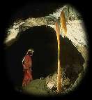
Caving is the recreational sport of exploring caves. Speleology is the scientific study of caves and the cave environment.
The challenges of the sport depend on the cave being visited, but often include the negotiation of pitches, squeezes, and water. Climbing or crawling is often necessary, and ropes are used extensively.
Caving is often undertaken for the enjoyment of the activity or for physical exercise, but original exploration, or physical or biological science is an important goal for many cavers. Virgin cave systems comprise some of the last unexplored regions on Earth and much effort is put into trying to locate and enter them. In well-explored regions (such as most first-world countries), the most accessible caves have already been explored, and gaining access to new caves often requires digging or diving.
Caves have been explored out of necessity for thousands of years, but only in the last century or two has the activity developed into a sophisticated, athletic pastime. In recent decades caving has changed considerably due to the availability of modern protective wear and equipment. It has recently come to be known as an "extreme sport" by some (though not commonly considered as such by its practitioners, who may dislike the term for its perceived connotation of disregard for safety).
Many of the skills of caving can also be used in the nature activities of mine exploration and urban exploration.
Naming issues
Clay Perry — an American caver of the 1940s — wrote about a group of men and boys who explored and studied caves throughout New England. This group referred to themselves as spelunkers. This is regarded as the first use of the word in the Americas. Throughout the 1950s, spelunking was the general term used for exploring caves in US English. It was used freely, without any positive or negative connotations, although only rarely outside the US.
In the 1960s, the term "spelunking" began to convey the idea of inexperienced cavers, using unreliable light sources and cotton clothing. In 1985, Steve Knutson (editor of American Caving Accidents) made the following distinction:
- "...Note that I use the term 'spelunker' to denote someone untrained and unknowledgeable in current exploration techniques, and 'caver' for those who are."
This sentiment is exemplified by bumper stickers and t-shirts displayed by many cavers: "Cavers rescue spelunkers".
Potholing refers to the act of exploring potholes, a word originating in the north of England for predominantly vertical caves. The term is often used as a synonym for caving, and outside the caving world there is a general impression that potholing is a more "extreme" version of caving.[citation needed]
Practice and equipment

Helmets are worn to protect the head from bumps and falling rocks. The caver's primary light source is usually mounted on the helmet in order to keep the hands free. Electric lights are most common, with halogen lamps being standard and white LEDs as the new competing technology. Many cavers carry three or more sources of light - one as primary and the others as backup in case the first fails. More often than not, a second light will be mounted to the helmet for quick transition if the primary fails. Carbide-based systems are still popular, especially on expeditions.
The type of clothes worn underground varies according to the environment of the cave being explored, and the local culture. In cold caves, the caver may wear a warm base layer that retains its insulating properties when wet, such as a fleece ("furry") suit and/or polypropylene underwear, and an oversuit of hard-wearing (e.g., cordura) and/or waterproof (e.g., PVC) material. Lighter clothing may be worn in warm caves, particularly if the cave is dry, and in tropical caves thin polypropylene clothing is used, to provide some abrasion protection whilst remaining as cool as possible. Wetsuits may be worn if the cave is particularly wet or involves stream passages. On the feet boots are worn - hiking-style boots in drier caves, or rubber boots (such as wellies) often with neoprene socks ("wetsocks") in wetter caves. Knee-pads (and sometimes elbow-pads) are popular for protecting joints during crawls. Depending on the nature of the cave, gloves are sometimes worn to protect the hands against abrasion and/or cold. In pristine areas and for restoration, clean oversuits and powder-free, non-latex surgical gloves are used to protect the cave itself from contaminants.
Ropes are used for descending or ascending pitches ("Single Rope Technique") or for protection. Knots commonly used in caving are the figure-of-eight- (or figure-of-nine-) loop, bowline, alpine butterfly, and Italian hitch. Ropes are usually rigged using bolts, slings, and karabiners. In some cases cavers may choose to bring and use a flexible metal ladder.
In addition to the equipment already described, cavers frequently carry packs containing first-aid kits, emergency equipment, and food. Containers for securely transporting urine are also commonly carried. On longer trips, containers for securely transporting faeces out of the cave are carried.
During very long trips, it may be necessary to camp in the cave. This necessitates the caver carrying sleeping and cooking equipment.
Safety

Caves can be dangerous places; hypothermia, falling, flooding, and physical exhaustion are the main risks. Rescue from underground is difficult and time-consuming, and requires special skills, training, and equipment. Full-scale cave rescues often involve the efforts of dozens of rescue workers, who may themselves be put in jeopardy in effecting the rescue. This said, caving is not necessarily a high-risk sport (especially if it does not involve difficult climbs or diving). As in all physical sports, knowing one's limitations is key.
The risks are minimised by a number of techniques:
- Checking that there is no danger of flooding during the expedition. Rainwater funneled underground can flood a cave very quickly, trapping people in cut-off passages and drowning them. After falling, this is the most likely fatal accident in caving.[citation needed]
- Using teams of several, preferably at least of four cavers. If an injury occurs, one caver stays with the injured person while the other two go out for help, providing assistance to each other on their way out.
- Notifying people outside the cave as to the intended return time. After an appropriate delay without a return, these will then organise a search party (usually made up by other cavers trained in cave rescues, as even professional emergency personnel are unlikely to have the skills to effect a rescue in difficult conditions).
- Use of helmet-mounted lights (hands-free) with extra batteries. American cavers recommend a minimum of three independent sources of light per person, but two lights is common practice amongst European cavers.[citation needed]
- Sturdy clothing and footwear, as well as a helmet, are necessary to reduce the impact of abrasions, caver falls, and falling objects. Synthetic fibers and woolens, which dry quickly, shed water, and are warm when wet, are vastly preferred to cotton materials, which retain water and increase the risk of hypothermia. It is also helpful to have several layers of clothing, which can be shed (and stored in the pack) or added as needed. In watery cave passages, polypropylene thermal underwear or wetsuits may be required to avoid hypothermia.
- Cave passages look different from different directions. In long or complex caves, even experienced cavers can become lost. To reduce the risk of becoming lost, it is necessary to memorise the appearance of key navigational points in the cave as they are passed by the exploring party. Each member of a cave party shares responsibility for being able to remember the route out of the cave. In some caves it may be acceptable to mark a small number of key junctions with small stacks or "cairns" of rocks, or to leave a non-permanent mark such as high-visibility flagging tape tied to a projection.
- Vertical caving using ladders or SRT (Single Rope Technique) to avoid the need for climbing passages that are too difficult. SRT however is a complex skill and requires proper training before use underground and needs well-maintained equipment. Some drops that are abseiled down may be as deep as several hundred meters (for example Harwood Hole).
Cave conservation

Many cave environments are very fragile. Many speleothems can be damaged by even the slightest touch and some by impacts as slight as a breath.
Pollution is also of concern. Since water that flows through a cave eventually comes out in streams and rivers, any pollution may ultimately end up in someone's drinking water, and can even seriously affect the surface environment, as well. Even minor pollution such as dropping organic material can have a dramatic effect on the cave biota.
Cave-dwelling species are also very fragile, and often, a particular species found in a cave may live within that cave alone, and be found nowhere else in the world. Cave-dwelling species are accustomed to a near-constant climate of temperature and humidity, and any disturbance can be disruptive to the species' life cycles. Though cave wildlife may not always be immediately visible, it is typically nonetheless present in most caves.
Bats are one such fragile species of cave-dwelling animal. Despite their often frightening reputation in fiction and in the movies, bats generally have more to fear from humans than vice-versa. Bats can be beneficial to humans in many ways, especially through their important ecological role in reducing insect pest populations, and pollination of plant species. Bats which hibernate are most vulnerable during the winter season, when no food supply exists on the surface to replenish the bat's store of energy should it be awakened from hibernation. Bats which migrate are most sensitive during the summer months when they are raising their young. For these reasons, visiting caves inhabited by hibernating bats is discouraged during cold months; and visiting caves inhabited by migratory bats is discouraged during the warmer months when they are most sensitive and vulnerable.
Some cave passages may be marked with flagging tape or other indicators to show biologically, aesthetically, or archaeologically sensitive areas. Marked paths may show ways around notably fragile areas such as a pristine floor of sand or silt which may be thousands of years old, dating from the last time water flowed through the cave. Such deposits may easily be spoiled forever by a single misplaced step. Active formations such as flowstone can be similarly marred with a muddy footprint or handprint, and ancient human artifacts, such as fiber products, may even crumble to dust under the touch of any but the most careful archaeologist.
Mining
"Miner" redirects here. For other meanings, see Miner (disambiguation).

Mining is the extraction of valuable minerals or other geological materials from the earth, usually (but not always) from an ore body, vein, or (coal) seam. Materials recovered by mining include bauxite, coal, copper, gold, silver, diamonds, iron, precious metals, lead, limestone, nickel, phosphate, oil shale, rock salt, tin, uranium, and molybdenum. Any material that cannot be grown from agricultural processes, or created artificially in a laboratory or factory, is usually mined. Mining in a wider sense can also include extraction of petroleum, natural gas, and even water.
History

The oldest known mine in the archaeological record is the "Lion Cave" in Swaziland. At this site, which by radiocarbon dating is 43,000 years old, paleolithic humans mined for the iron-containing mineral hematite, which they ground to produce the red pigment ochre. Sites of a similar age where Neanderthals may have mined flint for weapons and tools have been found in Hungary.
Ancient Egyptians operated malachite mines at Wady Maghareh on the Sinai Peninsula and at Timna in the Negev. At first, the bright green stones were used for ornamentation and for pottery glaze, but approximately 1,200 BCE, Egyptians discovered that malachite could be converted into copper by the application of intense heat and air.
In North America there are ancient, prehistoric copper mines along Lake Superior that were part of an extensive native trade network of copper tools, points, arrowheads, and artifacts. Some copper points that were found are over 3000 to 4000 years old, and copper was traded throughout the continent along major river routes. In addition, quartz, flint, and other minerals were also mined, worked, and traded. In Manitoba there are ancient quartz mines in the north, and in Southeastern Manitoba by the Winnipeg River in Whiteshell Provincial Park.
Turquoise was mined in pre-Columbian America in the Cerillos Mining District in New Mexico, where a mass of rock 200 feet (60 m) in depth and 300 feet (90 m) in width was removed with stone tools; the mine dump covers 20 acres (81,000 m²). Black gun powder in mining was first used in a mineshaft under Banská Štiavnica, Slovakia in 1627 , in the same town in 1762 the first Mining Academy in the world was established.
Mining in the United States became prevalent in the 19th century. Mining for minerals and precious metals, such as in the California Gold Rush in the mid 1800s, was very important in westward expansion to the Pacific coast along with ranching and exploration of oil and gas fields. During this time period many white Americans and post-slavery African Americans, with the aid of railroads, traveled west for work opportunities in mining. Many western cities such as Denver and Sacramento originated as mining towns.
Procedure
Steps of process
- Prospecting to locate ore
- Exploration to find and then define the extent and value of ore where it is located ("ore body")
- Conduct resource estimate to mathematically estimate the extent and grade of the deposit
- Conduct mine planning to evaluate the economically recoverable portion of the deposit (and including reclamation planning)
- Conduct a feasibility study to evaluate the total project and make a decision as whether to develop or walk away from a proposed mine project. This includes a cradle to grave analysis of the possible mine, from the initial excavation all the way through to reclamation.
- Development to create access to an ore body
- Exploitation to extract ore on a large scale
- Reclamation to make land where a mine had been suitable for future use
Techniques

Mining techniques can be divided into two basic excavation types:
Solution mining is a particular mining technique that is used to mine minerals (potash, potassium chloride, sodium chloride, sodium sulphate) which dissolve in water.
Extractive metallurgy
The science of extractive metallurgy is a specialized area in the science of metallurgy that studies the extraction of valuable metals and minerals from their ores, especially through chemical or mechanical means. Mineral processing (or mineral dressing) is a specialized area in the science of metallurgy that studies the mechanical means of crushing, grinding, and washing that enable the separation (extractive metallurgy) of valuable metals or minerals from their gangue (waste material).
- See also: biomineralization
Environmental effects
Environmental issues can include erosion, formation of sinkholes, loss of biodiversity, and contamination of groundwaters and surface water by chemicals from the mining process and products.
Modern mining companies in some countries are required to follow environmental and rehabilitation codes, ensuring the area mined is returned to close to its original state. In some countries with pristine environments, such as large parts of Australia, this is impossible despite the best intentions. Some mining methods have devastating environmental and public health effects.
Mining can have adverse effects on surrounding surface and ground water if protection measures are not exercised. The result can be unnaturally high concentrations of some chemical elements, notably arsenic and sulfuric acid, over a significantly large area of surface or subsurface. Coal mining releases approximately twenty toxic chemicals, of which 85% is said to be managed on site. Combined with the effects of water and the new 'channels' created for water to travel through, collect in, and contact with these chemicals, a situation is created in which massive contamination can occur. In well-regulated mines, hydrologists and geologists take careful measures to mitigate any type of water contamination that could be caused by mines. In modern American mining, operations must, under federal and state law, meet standards for protecting surface and ground waters from contamination, including acid mine drainage (AMD). To mitigate these problems water is continuously monitored at coal mines. The five principal technologies used to control water flow at mine sites are: diversion systems, containment ponds, groundwater pumping systems, subsurface drainage systems, and subsurface barriers. In the case of AMD, contaminated water is generally pumped to a treatment facility that neutralizes the contaminants.

Some examples of environmental problems associated with mining operations are:
- Ashio Copper Mine, Ashio, Japan was the site of substantial pollution at end of the nineteenth century
- Berkeley Lake, an abandoned pit mine in Butte, Montana that has filled with water which is now acidic and poisonous. In 2003, a water treatment plant came on-line, initially treating "new" water entering the pit, thereby reducing the rate of rise of pit water. Treated water is currently used in the concentrator of the nearby Montana Resources Continental Pit, but it is clean enough to return to Silver Bow Creek. Eventually, water in the pit itself will be treated.
- Britannia Mines, a former copper mine near Vancouver, British Columbia. Copper from the abandoned mine washes into Howe Sound, polluting the water. No animal life remains there now. - Latest reports are that after a water treatment plant was put in, fish are returning to Britannia Bay - maybe for the first time ever. The name used by the First Nations tribes of Britannia Beach, even before mining started, means "The Place of No Fish".
- Scouriotissa, a copper mine in Cyprus that has been abandoned. Contaminated dust blows off this site.
- Tar Creek, an abandoned mining area in Picher, Oklahoma that is now an Environmental Protection Agency superfund site. Water in the mine has leaked through into local groundwater, contaminating it with metals such as lead and cadmium.[1]
- Wheal Jane Mine, a former tin mine in West Cornwall, UK, where around 1992/1993 acid mine drainage rose through the abandoned mine and escaped into the surface water systems of the Carnon Valley.
Although such issues have been associated with some mining operations in the past, modern mining practices have improved significantly and are subject to close environmental scrutiny, occasionally lessening environmental damage somewhat. To ensure completion of reclamation (restoring mine land) the Office of Surface Mining requires that mining companies post a bond to be held in escrow until productivity of reclaimed land has been convincingly demonstrated. Since 1978 the mining industry has reclaimed more than 2 million acres (8,000 km²) of land. This reclaimed land has renewed vegetation and wildlife in previous mining lands and can even be used for farming and ranching.
For further reading on reclamation of former mining sites, see Restoration ecology.
Mining industry
Overview
While exploration and mining can sometimes be conducted by individual entrepreneurs or small business, most modern-day mines are large enterprises requiring large amounts of capital to establish. Consequently, the mining sector of the industry is dominated by large, often multinational, mostly publicly-listed companies. See Category:Mining companies for a list. However, what is referred to as the 'mining industry' is actually two sectors, one specializing in exploration for new resources, the other specializing in mining those resources. The exploration sector is typically made up of individuals and small mineral resource companies dependent on public investment. The mining sector is typically large and multi-national companies sustained by mineral production from their mining operations.
Employment
United States
Miners today do more than just dig tunnels in the Earth's subsurface. There are many different jobs, direct and indirect, in the mining industry, ranging from engineers and lab technicians to geologists and environmental specialists. Beyond employment directly linked to mine-site activity, the modern mining industry also employs many other professionals, including accountants, lawyers, sales representatives, public relations specialists, not to mention thousands of men and women involved who manufacture the machines and equipment necessary to mine minerals.
Employment in the mining industry offers highly competitive wages and benefits, especially in rural or remote areas. According to the Bureau of Labor Statistics (BLS), wages for coal miners are 30% higher than the wage earned by the average American. Employees possessing at least a bachelor's degree in mining or geological engineering can earn a median pay of over $80,000 annually.
The US Bureau of Labor Statistics estimates that 675,000 are employed in the natural resources and mining sector. Estimated employment by selected specific commodity (including mine, mill, smelter, and quarry workers) listed below is from US Geological Survey Mineral Commodity Surveys:
- Crushed Stone - 79,700 workers
- Copper - 7,000
- Cement - 18,000
- Sand and Gravel - 38,300
- Gold - 7,600
- Aluminum - 56,000
- Iron Ore - 4,400
- Platinum Group Metals - 1,600
- Salt - 4,100
- Phosphate Rock - 2,900
The mining industry has an experienced but aging workforce with a mean average age of 50 years and median of 46 years. Indeed, while the industry will require new employees to meet future demand, the largest dilemma currently facing mine operators is finding employees to fill vacancies left by a generation of miners, mine engineers, senior managers, technical experts and others who are set to retire between 2005 and 2015. However, the industry is struggling to meet that demand due to current low enrollment levels in mining education programs at American colleges and universities.
Mining is regulated under a comprehensive federal safety law (Federal Mine Safety and Health Act) that is administered by the Department of Labor's Mine Safety and Health Administration (MSHA). Currently under federal law, and enforced by MSHA each U.S. miner must have an approved worker training program in health and safety issues, including at least 40 hours of basic safety training for new underground miners with no experience; 24 hours for new miners at surface mines with no experience; plus eight hours of annual refresher training for all miners.
Safety
United states
Safety has long been a controversial issue in the mining business especially with sub-surface mining. While mining today is substantially safer than it was in the previous decades, mining accidents and tragedies are often very high profile such as the Quecreek Mine Rescue saving 9 trapped Pennsylvania coal miners in 2002.
Mining ventilation is also seen to be a safety concern for many miners and their families. Poor ventilation of mining causes exposure to harmful gases, heat and dust inside sub-surface mines. These can cause harmful physiological effects or death. Methane gas is a common source of ignition of explosions in coal mines and can propagate into the more violent coal dust explosions. High temperatures and humidity may result in any of the heat illnesses including heat stroke which can be fatal. Dusts can cause lung problems. These include silicosis, asbestosis and pneumoconiosis also known as miners lung or black lung disease.
A ventilation system is set up to course air through the working areas of the mine. The air movement necessary for effective mine ventilation is generated by one or more large mine fans usually located above ground. In the United States, main fans at coal mines are required to be above ground. Air flows in one direction only, making circuits through the mine such that each main work area receives a supply of fresh air.
Mining is regulated under the federal Mine Safety and Health Act by MSHA, which employs nearly one safety inspector for every four coal mines. Underground coal mines are thoroughly inspected at least four times annually by MSHA inspectors. In addition, miners can report violations, request additional inspections and cannot lose their jobs for doing so.
The National Institute for Occupational Safety and Health (NIOSH), part of the Centers for Disease Control and Preventionunder the U.S. Department of Health and Human Services, conducts mining safety and health research, with the aim to eliminate mining fatalities, injuries, and illnesses through research and prevention.
Immediately reportable accidents and injuries are:
- A death of an individual at a mine;
- An injury to an individual at a mine which has a reasonable potential to cause death;
- An entrapment of an individual for more than thirty minutes;
- An unplanned inundation of a mine by a liquid or gas;
- An unplanned ignition or explosion of gas or dust;
- An unplanned mine fire not extinguished within 30 minutes of discovery;
- An unplanned ignition or explosion of a blasting agent or an explosive;
- An unplanned roof fall at or above the anchorage zone in active workings where roof bolts are in use; or, an unplanned roof or rib fall in active workings that impairs ventilation or impedes passage;
- A coal or rock outburst that causes withdrawal of miners or which disrupts regular mining activity for more than one hour;
- An unstable condition at an impoundment, refuse pile, or culm bank which requires emergency action in order to prevent failure, or which causes individuals to evacuate an area; or, failure of an impoundment, refuse pile, or culm bank;
- Damage to hoisting equipment in a shaft or slope which endangers an individual or which interferes with use of the equipment for more than thirty minutes; and
- An event at a mine which causes death or bodily injury to an individual not at the mine at the time the event occurs.
Statistical analyses performed by the U.S. Department of Labor's Mine Safety and Health Administration (MSHA) show that between 1990 and 2004, the industry cut the rate of injuries (a measure comparing the rate of incidents to overall number of employees or hours worked) by more than half and fatalities by two-thirds following three prior decades of steady improvement.
Machinery
Heavy machinery is needed in mining to break and remove rocks of diverse hardness and toughness. Bulldozers, drills, explosives and trucks are important for digging into the land, especially in surface mining.
Underground mining, like continuous mining, tends to be more technologically sophisticated because of the dangers and expense of subsurface tunneling.
Trams are used to transport miners, minerals and waste.
Mining machinery manufacturers include Joy Mining Machinery, Bucyrus International, Caterpillar, Komatsu, Volvo, Hitachi, Terex, Dresser Industries, Kawasaki, Eimco Elecon India Limited, and Liebherr.

Placer mining is a type of surface mining, usually for gold, tin, and other metals, and gemstones. Ore, typically unconsolidated gravels, is fed into machinery that may consist of a hopper, shaking screen or trommel which frees the minerals from the gravels. The target minerals are then concentrated using sluices or jigs.
Abandoned mines

It is estimated that there are between 700,000 and 800,000 abandoned mines in the United States. Many of these abandoned mines are associated with abandoned neighboring towns often referred to as ghost towns.
Experts strongly warn against entering or exploring old or abandoned mines. It is estimated that approximately 25% of the abandoned mine lands (AML) sites pose physical safety hazards. Old mines are often dangerous and can contain deadly gases, snakes, and other dangerous animals. The entrance to an old mine in particular can be very dangerous, as weather may have eroded the earth/rock surrounding the entrance. Old mine workings, caves, etc are commonly hazardous simply due to the lack of oxygen in the air (which in the context of mines is known as blackdamp) and this is a deadly killer which provides no warning to those entering such an environment.
Every year, dozens of people are injured or killed in recreational accidents on mine property. It is only fair to note, however, that the majority of these deaths are not related to mine exploration. Drownings in open quarries and ATV accidents on abandoned mine properties are the main culprits behind these deaths. MSHA (Mine Safety and Health Administration) launched the "Stay Out – Stay Alive" campaign in 1999. "Stay Out–Stay Alive" is a national public awareness campaign aimed at warning and educating children and adults about the dangers of exploring and playing on active and abandoned mine sites.
The Abandoned Mine Land Initiative, launched by the Western Governors Association, and the National Mining Association is an effort focusing on reporting the number of high-priority AML sites, and to identify, measure and report on the progress of current reclamation cleanup programs on an annual basis.
List of caves
.
The following is a partial list of caves.
. Africa
. Ethiopia
.South Africa
Main article: List of caves in South Africa
. Asia
. China
- Choukoutien cave system
- Mogao Caves
.Georgia (country)
- Novy Afon Cave
- Voronya Cave, in competition as world's deepest cave
. Vietnam
- Phong Nha-Ke Bang (Vietnamese:Phong Nha- Kẻ Bàng), world natural heritage, typical ancient tropical karst site.
- Tam Cốc-Bích Động (Ninh Bình province)
- Hương Tích (Hà Tây province)
- Tam Thanh (Lạng Sơn province)
. India
- Bagh Caves
- Badami Cave Temples
- Borra Caves
- Rock Shelters of Bhimbetka
- Elephanta Caves - includes a shiva temple
- Ellora Caves
- Karla Caves
- Krem Liat Prah
- Pandavleni Caves
- Varaha Cave Temple
. Iran
. Israel
. Japan
- Abukuma-do (阿武隈洞)
- Akiyoshi-do (秋芳洞)
- Akka-do (安家洞)
- Gyokusen-do (玉泉洞)
- Irimizu Shonyu-do (入水鍾乳洞)
- Kyusen-do (球泉洞)
- Ryuga-do (龍河洞)
- Ryusen-do (龍泉洞)
- Sugawatari-do (氷渡洞)
- Uchimagi-do (内間木洞)
. Korea
. Malaysia
Main article: List of caves in Malaysia
- Batu Caves, north of Kuala Lumpur
- Niah Caves in Sarawak
- Gomantong Caves in Sabah
- Malaysian Cave Register gives a comprehensive list of caves in the Malaysian Peninsula
- Perlis State Park
- Lenggong Valley, Perak Man Museum Perak
- Gunung Mulu National Park in Sarawak
- Ipoh cave temples in Perak
.Oman
. Philippines
. Europe
.Albania
. Austria
- Tropfsteinhöhle Alland
- Dachstein-Mammuthöhle
- Dachstein-Rieseneishöhle
- Dreidärrischenhöhle
- DÖF-Sonnleiter-Höhlensystem
- Eisensteinhöhle
- Eisriesenwelt
- Entrische Kirche
- Frauenmauerhöhle
- Gasselhöhle
- Grasslhöhle
- Griffener Tropfsteinhöhle
- Grubstein-Westwandhöhle
- Gudenushöhle
- Hirlatzhöhle
- Hüttstatthöhle
- Katerloch
- Kolkbläser-Monsterhöhle-System
- Koppenbrüllerhöhle
- Lamprechtsofen
- Loferer Schacht
- Lurgrotte
- Nixhöhle
- Obir-Tropfsteinhöhle
- Ötscher-Tropfsteinhöhle
- Prax-Eishöhle
- Ramesch-Knochenhöhle
- Rettenwand-Tropfsteinhöhle
- Scheukofen
- Schneckenlochhöhle
- Schwarzmooskogel-Höhlensystem
- Seegrotte (Hinterbrühl)
- Spannagelhöhle
- Südwandhöhle
- Tantalhöhle
- Tischofer Höhle
- Trübbachhöhle
. Bulgaria
- Bacho Kiro Cave
- Ledenika
- Snezhanka Cave
- Duhlata
- Temnata Dupka
- Magura
- Devetashka Cave
- Orlova Chuka
- Yagodinska Cave (Imamova Dupka)
- Raychova Dupka
. Belgium
.Croatia
Main article: List of caves in Croatia
- Velebit caves: Lukina jama, Slovačka jama, Patkov Gušt, etc
- Caves on Biokovo: Amfora, Stara škola, Vilimova jama
- Crveno jezero (the Red Lake) near Imotski
- Stupina jama in Gorski Kotar, near Rijeka
.Czech Republic
Main article: List of caves in Czech Republic
- Amatérská jeskyně, Czech largest cave in the Moravian Karst
- Býčí skála - Rudické propadání
- Kateřinská jeskyně
- Koněprusy Caves (Koněpruské jeskyně)
- Macocha Gorge (Propast Macocha)
- Punkevní jeskyně
- Sloupsko-šošůvské jeskyně
. France
Main article: List of caves in France
- Chauvet Cave
- Font de Gaume
- Gouffre Berger, the first cave explored to more than 1000m depth
- Grotte des Demoiselles, a popular regional tourist attraction in southern France
- Jean Bernard System, in competition as world's deepest cave
- Lascaux Cave
- Mas d'Azil Cave
- Mirolda Cave, in competition as world's deepest cave
- Niaux Cave
- Orgnac Cave
- Padirac Cave
- Pierre-Saint-Martin System
- Aven-Grotte de la Forestière (Ardèche)
.Germany
Main article: List of caves in Germany
- Aggertalhöhle
- Amandahöhle
- Altensteiner Höhle
- Atta-Höhle
- Aufberger Loch
- Balver Höhle
- Bärenhöle
- Bärenhöhle in Sonnenbühl
- Baumannshöhle
- Bauerloch
- Bernhardshöhle
- Bilsteinhöhle
- Binghöhle
- Blautopf
- Bocksteinhöhle
- Bocksteinschmiede
- Brunnensteighöhle
- Brunnensteinhöhle
- Charlottenhöhle
- Dampfloch
- Dechenhöhle
- Diebeshöhle
- Dohlenhöhle
- Drachenhöhle Syrau
- Dreieingangshöhle
- Eberstadter Tropfsteinhöhle
- Eichbergschacht
- Einhornhöhle
- Die Eishöhlen bei Birresborn
- Elsachbröller
- Erdmannshöhle
- Falkensteiner Höhle
- Finsterloch
- Fuchsloch
- Große Scheuer
- Gußmannshöhle
- Gutenberger Höhle
- Haus
- Heimensteinhöhle
- Heimkehle
- Heinrichshöhle
- Hermannshöhle
- Himmelsfelsenschacht
- Höhle in der Hölle
- Hohler Fels
- Hohler Fels
- Hohler Stein
- Hohler Stein
- Hölloch
- Höllsternbröller
- Hölzlesloch
- Iberger Tropfsteinhöhle
- Kakushöhle
- Karlshöhle
- Kleine Scheuer
- Kleine Scheuer
- Kluterthöhle
- Kolbinger Höhle
- König-Otto-Tropfsteinhöhle
- Kubacher Kristallhöhle
- Kübelhöhle
- Laichinger Tiefenhöhle
- Maximiliansgrotte
- Mordloch Höhle
- Nebelhöhle
- Niederaltdorfer Tuffhöhle
- Ofnet Höhlen
- Olgahöhle
- Osterhöhle
- Pliksburggrotten
- Rainloch
- Reckenhöhle
- Reinsberger Bröller
- Schellenberger Eishöhle
- Schertelshöhle
- Schillat-Höhle
- Schillerhöhle
- Die Schlossberghöhlen
- Schreiberhöhle
- Schulerloch
- Segeberger Höhle
- Sontheimer Höhle
- Sophienhöhle
- Stadel
- Steinernes Haus
- Stöckelberghöhle
- Studerbildschacht
- Sturmannshöhle
- Teufelshöhle (bei Pottenstein)
- Teufelshöhle (bei Steinau)
- Teufelsküche (Gültigshofen)
- Todsburger Höhle
- Todsburger Schacht
- Tschamberhöhle
- Vogelherdhöhle
- Wendelsteinhöhle
- Wiehler Tropfsteinhöhle
- Wimsener Höhle
- Ziegelhöhle
- Zwiefaltendorfer Tropfsteinhöhle
.Gibraltar
. Greece
Main article: List of caves in Greece
- Cave Lakes, SE of Kalavryta
- Corycian Cave
- Dirou Cave, Mani Peninsula
- Melissos Cave, Kefallinia
- Blue Cave, Kastellórizo
.Hungary
. Ireland
. Italy
Main article: List of caves in Italy
- Blue Grotto, Capri, Campania
- Castellana Caves, Puglia
- Ear of Dionysius, Syracuse, Sicily
- Tiscali, Sardinia
- Zelbio, Como, Lombardy
- Frasassi Caves, Marche
- Grotta Gigante, Trieste, Friuli-Venezia Giulia
. Macedonia
Main article: List of caves in Macedonia
- Slatinski Izvor - longest in Macedonia.
- Solunska Glava 5 - deepest in Macedonia 450m.
- Solunska ? - Deepest Pit 300m.
.Malta
Main article: List of caves in Malta
- Blue Grotto, Wied iż-Żurrieq, Qrendi
- Blue Window Cave, Wied iż-Żurrieq, Żurrieq
- Cat's Cave, Wied iż-Żurrieq, Qrendi
- Ghar Baqrat, Għadira, Mellieħa
- Ghar Barka, Tal-Lunzjata, Rabat
- Ghar Berbah, Xemxija, San Pawl il-Baħar
- Ghar Bittija, Dingli
- Ghar Dalam, Qajjenza, Birżebbuġa
- Ghar Gerduf, Lunzjata Valley, Rabat, Gozo
- Ghar Hasan, Ħal Far, Birżebbuġa
- Ghar id-Dud, Sliema
- Ghar il-Gobon, Birkirkara
- Ghar il-Kbir, Buskett, Siġġiewi
- Ghar il-Lembi, Sliema
- Ghar Ilma, Santa Luċija, Kerċem, Gozo
- Ghar ix-Xaghra, Wied Ħoxt, Qrendi
- Ghar Lapsi, Siġġiewi
- Ghar Mirdum, Tal-Kalċ, Dingli
- Ghar Mundu, Girgenti, Siġġiewi
- Ghar Qawqla, Marsalforn, Żebbuġ, Gozo
- Ghar ta' Ghejzu, Ġgantija Area, Xagħra, Gozo
- Ghar ta' Karolina, Xlendi, Munxar, Gozo
- Ghar ta' l-Gharusa or Honeymoon Cave, Wied iż-Żurrieq, Qrendi
- Ghar ta' Xerri, Xagħra, Gozo
- Ghar ta' Ninu, Xagħra, Gozo
- Ghar ta' Zazu, Wied iż-Żurrieq, [[Qrendi]
- Għar tal-Madonna, Mellieħa
- Ghar tal-Munqar, Żurrieq
- Ghar u Casa, Mellieħa
- Gozo Blue Grotto, Dwejra, San Lawrenz, Gozo
- Reflection Cave, Qrendi
.Norway
Poland
Main article: List of caves in Poland
- Jaskinia Wielka Śnieżna, Western Tatras
- Śnieżna Studnia, Western Tatras
- Bańdzioch Kominiarski, Western Tatras
- Smocza Jama, Kraków
Portugal
Main article: List of caves in Portugal
Romania
Serbia
Sweden
Main article: List of caves in Sweden
- Lummelundagrottan, Gotland
- Barnekällagrottan, Skåne
- Balsbergsgrottan, Skåne
- Jungfrugrottan, Skåne
- Korallgrottan, Jämtland
Switzerland
Main article: List of caves in Switzerland
- Hölloch, a 190km long cave
- Sieben Hengste-Hohgant-Bärenschacht system, a 230 km long cave
Slovakia
Main article: List of caves in Slovakia
- Dead Bats Cave (Jaskyňa Mŕtvych netopierov)
- Demänová Caves (Demänovský jaskynný systém)
-
- Demänovská jaskyňa Slobody (literally Demänová Cave of Freedom)
- Demänovská Ice Cave (Demänovská ľadová jaskyňa)
- Dobšinská Ice Cave (Dobšinská ľadová jaskyňa)
- Domica
- Driny
- Gombasek Cave (Gombasecká jaskyňa)
- Harmanecká Cave (Harmanecká jaskyňa)
- Jasovská Cave (Jasovská jaskyňa)
- Javorinka
- Ochtinská Aragonite Cave (Ochtinská aragonitová jaskyňa)
- Stratenská Cave (Stratenská jaskyňa)
- Važecká Cave (Važecká jaskyňa)
Slovenia
- Planinska jama, near Postojna
- Postojna Cave (Postojnska jama), Postojna
- Caves of Škocjan (Škocjanske jame), near Divača
- Vilenica, the world's first tourist cave near Sežana
- Cave of Kostanjevica (Kostanjeviška jama)
- Mayor's Cave (Županova jama), formerly Tabor Cave (Taborska jama), near Grosuplje
- The Cave of Cross (Križna jama), near Cerknica
- The caves of Kanin in the Julian Alps, including Vrtoglavica, the deepest pitch in the world as of 2005
Spain
Main article: List of caves in Spain
- Altamira, in Cantabria, famous for its Upper Paleolithic paintings.
- Cuevas del Drach, on Mallorca, containing one of the largest subterranean lakes in the world
- Torca Del Cerro, Picos de Europa, Spain's deepest cave, and the fifth deepest cave in the world.
Turkey
Main article: List of caves in Turkey
- EGMA, aka "Peynirlikönü Sinkhole"
- Aladag Meydan Bigbig in Adana, aka "Colourful Caves"
- Damlatas in Antalya, aka "Dropstone Caves"
- Karain, aka "Black Caves"
- Derya, aka "Sea Caves"
- Beldibi, aka "Mountain Caves"
- Sirtlanini, aka "Hyena Caves"
- Aynali in Amasya, aka "Mirror Caves"
- Aslanli/Yaren in Kuşadası, aka "Lion Caves"
- Insuyu in Burdur, aka "CaveWater Caves"
- Buzluk, aka "Ice Caves"
- Ballica, aka "Honey Caves"
- Yerkure, aka "Earthsphere Caves"
- Gokgol, aka "Skylake Caves"
- Cehennemagzi, aka "The Hell Mouth Caves"
- Frig Vadisi, aka "Frigian Caves"
- Sabuncupinar, Inlikoy Caves aka "The Cave Villages"
- Zindan, aka "Chamber Caves"
- Ayi Ini, aka "The Bear Caves"
- Çukurpınar
- Cennet Obruk, aka "Heaven Caves"
- Zeus Caves
- Ayvaini Cave
Ukraine
Main article: List of caves in Ukraine
- Pechera Optymistychna, second largest cave in the world, gypsum cave
- Pechera Ozerna, gypsum cave
- Priest's Grotto, cave where Jews hid from Nazi occupation
United Kingdom
Main article: List of caves in the United Kingdom
- Aveline's Hole, Mendip Hills, Somerset
- Blue John Cavern, Derbyshire
- Chislehurst Caves, Kent
- Cleeves Cove cave, North Ayrshire, Scotland.
- Cox's cave, Mendip Hills, Somerset
- Dan yr Ogof, South Wales
- Eastwater Cavern, Mendip Hills, Somerset
- Easegill System, Yorkshire Dales
- Fingal's Cave, Inner Hebrides
- Gaping Gill, Yorkshire Dales
- GB Cave, Mendip Hills, Somerset
- Goatchurch Cavern, Mendip Hills, Somerset
- Gough's Cave, Mendip Hills, Somerset
- Kent's Cavern, Devon
- Lamb Leer, Mendip Hills, Somerset
- Mossdale Caverns, Yorkshire Dales
- Ogof Agen Allwedd, South Wales
- Ogof Craig a Ffynnon, South Wales
- Ogof Draenen, South Wales
- Ogof Ffynnon Ddu, South Wales
- Ogof y Daren Cilau, South Wales
- Pate Hole, Cumbria
- Peak Cavern, Derbyshire
- Smoo Cave, Sutherland
- Speedwell Cavern, Derbyshire
- St Cuthbert's Swallet, Mendip Hills, Somerset
- Swildon's Hole, Mendip Hills, Somerset
- Thrupe Lane Swallet, Mendip Hills, Somerset
- Treak Cliff Cavern, Derbyshire
- Wookey Hole Caves, Mendip Hills, Somerset
- Pridhamsleigh Cavern, Dartmoor, Devon
- Bakers pit, Dartmoor, Devon
- Afton Red Rift, Dartmoor, Devon
- Primrose Pot, Mendip hills, Somerset
- Stoke Lane Slocker, Mendip Hills
- Longwood Swallet, Mendip Hills, Somerset
- Manor Farm Swallet, Mendip Hills, Somerset
- Rhino Rift, Mendip Hills, Somerset
- Withyhill Cave, Mendip Hills, Somerset
- Shatter Cave, Mendip Hills, Somerset
- Wigmore Swallet, Mendip Hills, Somerset
- Priddy Green Sink, Mendip Hills, Somerset
- Afton Red Rift, Dartmoor, Devon
- Otter Hole, Forest of Dean, Gloucestershire
- Slaughter Stream Cave, Forest of Dean, Gloucestershire
- Redhouse Lane Swallet, Forest of Dean, Gloucestershire
- Porth Yr Ogof, South Wales
- Bridge Cave, South Wales
- Little Neath River Cave, South Wales
- Elm Hole, South Wales
- Ogof Hesp Alyn, North Wales
- Ogof Llyn Parc, North Wales
Oceania
Main article: List of caves in Oceania
Australia
Main article: List of caves in Australia
- Mount Etna Caves National Park, Queensland
- Naracoorte Caves, South Australia
- Jenolan Caves, Blue Mountains, New South Wales
- Buchan Caves, Snowy Mountains, Victoria
New Zealand
Main article: List of caves of New Zealand
- Aurora Cave
- Bulmer Cavern
- Harwood Hole
- Maori Leap Cave
- Nettlebed Cave
- Riwaka Resurgence
- Ruakuri Cave
- Waipu Caves
- Waitomo Caves
Papua New Guinea
Main article: List of Caves in Papua New Guinea
North America
Canada
Cave names are presented alphabetically followed by the nearest town or park. More information about caving in Canada can be found on [2].
- Arctomys Cave in Mount Robson Provincial Park, British Columbia
- Cadomin Cave near Hinton, Alberta
- Canyon Creek Ice Cave near Bragg Creek, Alberta
- Castleguard Cave in Banff National Park, Alberta
- Cave and Basin National Historic Site in Banff National Park, Alberta
- Site cavernicole de Saint-Léonard in Saint Léonard, Montreal, Quebec
- Cody Caves near Ainsworth, British Columbia
- Gargantua near Crowsnest Pass, Alberta
- Hoodoo Cave near Nordegg, Alberta
- Horne Lake Caves on Vancouver Island, British Columbia
- Rat's Nest Cave near Canmore, Alberta
- Thanksgiving Cave on Vancouver Island, British Columbia
- Trou du Diable in St-Casimir, Quebec
- Wapiabi Cave near Nordegg, Alberta
Mexico
Main article: List of caves in Mexico
- Systema Huautla (Oaxaca)
- Guila Naquiz Cave (Oaxaca, ca.8000-6700B.C.)
- Nogales Cave (Tamaulipas, ca.5000-3000B.C.)
- Coxcatlan Cave (Tehuacan Valley, Puebla,5000-3400B.C.)
- La Perra Cave (Tamaulipas, ca.3000-2200B.C.)
- Juxtlahuaca Cave (Guerrero, Olmec-style painting cave)
- Oxtotitlan Cave (Guerrero, Olmec-style painting cave)
- Loltun Cave (Yucatán, a painting cave of Maya civilization)
- Balank'anche Cave (Yucatan, people offered a worship to Rain God and Xipe Totec with Toltec-Style cencers)
- Sistema Ox Bel Ha (Quintana Roo) (world's largest known underwater cave system)
- Nohoch Nah Chich (Quintana Roo) (world's second largest known underwater cave system)
- Cave of Swallows (Cave of the Swallows) (Spanish: Sótano de las Golondrinas)
United States of America
Main article: List of caves in the United States
- Ape Cave, Washington (lava tube)
- Big Bone Cave, Tennessee
- Blanchard Springs Caverns, Arkansas
- Black Chasm Cavern, California
- Bluespring Caverns, Indiana
- Boyden Cavern, California
- Bridal Cave, Missouri
- Bronson Caverns, California
- Butter Cave, Washington
- California Caverns, California
- Carlsbad Caverns, New Mexico
- Cascade Caverns, Texas
- Cave of the Mounds, Wisconsin
- Cave of the Winds, Colorado Springs, Colorado
- Cheese Cave, Washington
- Christmas Tree Cave, Washington
- Clarksville Cave, New York
- Cosmic Cavern, Arkansas
- Crystal Cave, any of several caves in Ohio, Wisconsin, and California's Sequoia National Park
- Crystal Cavern, Alabama
- Cumberland Caverns, Tennessee
- Deadhorse Cave, Washington
- DeSoto Caverns, Alabama
- Diamond Caverns, Kentucky
- Endless Caverns, Virginia
- Fantastic Caverns, Missouri
- Florida Caverns, Florida
- Gage Cave, New York
- Glenwood Caverns (Fairy Cave), Glenwood Springs, Colorado
- Grand Caverns, Virginia
- Great Onyx Cave, Kentucky
- Guler Ice Cave, Washington
- Hellhole, West Virginia
- Hidden River Cave, Kentucky
- Howe Caverns, New York
- Illinois Caverns, Illinois
- Inner Space Caverns, Texas
- Jacob's Cave, Missouri
- Jewel Cave, South Dakota
- John Guilday Cave Preserve, West Virginia
- Kartchner Caverns, Arizona
- Kazumura Cave, Hawaii (lava tube)
- Knox Cave, New York
- Lake Shasta Caverns, California
- Laurel Caverns, Pennsylvania
- Lava River Cave, Oregon (lava tube)
- Lava Beds National Monument, California (lava tubes)
- Lechuguilla Cave, New Mexico
- Lehman Caves, Nevada
- Lewis and Clark Caverns, Montana
- Lincoln Caverns, Pennsylvania
- Linville Caverns, North Carolina
- Lockport Cave, New York
- Lost River Cave, Kentucky
- Lost Sea Caverns, Tennessee
- Lost World Caverns, West Virginia
- Luray Caverns, Virginia
- Mammoth Cave, Kentucky
- Marengo Cave, Indiana
- Mary Campbell Cave, Ohio
- Mercer Caverns, California
- Meramec Caverns, Missouri
- Mitchell Caverns, California
- Moaning Cavern, California
- Natural Bridge Caverns, Texas
- Natural Bridge Caverns, Virginia
- Natural Stone Bridge and Caves, New York
- Ohio Caverns, Ohio
- Onondaga Cave, Missouri
- Paradise Ice Cave, Washington
- Penns Cave, Pennsylvania
- Russell Cave, Alabama
- Schoharie Cave, New York
- Secret Cavern, New York
- Seneca Caverns, Ohio
- Seneca Caverns, West Virginia
- Shennandoah Caverns, Virginia
- Skeleton Cave, Oregon
- Skyline Caverns, Virginia
- Smoke Hole Caverns, West Virginia
- Squire Boone Cave, Indiana
- Spring Cave, Colorado
- Subway Cave, California
- Sunny Jim Cave, California
- Talking Rocks Cavern, Missouri
- Timpanogos Cave National Monument, Utah
- Vasco Caves, California
- Wind Cave National Park, South Dakota
- Wonder Cave, Texas
- Wyandotte Caves, Indiana
Central America
Belize
- Actun Box Ch'iich'
- Actun Chapat
- Actun Halal
- Actun Tunichil Muknal
- Actun Tun Kul - includes Belize Chamber
- Cebada Cave
- Kabal Group
Guatemala
- Jul Mas Nim
- Naj Tunich
- Xibalba
South America
Argentina
- Cueva de las Manos (Cave of the hands)
Brazil
- Caverna dos Ecos, Goiás
- Gruta do Centenario
- Gruta Maquine, Lagoa Santa, Minas Gerais
- Gruta Rei do Mato, Sete Lagoas, Minas Gerais
- Parque da Cascata, Sete Lagoas, Minas Gerais
- Toca da Barriguda, Bahia - second longest in Brazil
- Toca da Boa Vista, Bahia - longest in the Southern hemisphere
Colombia
- Guacharos cave in Guacharos National Park [3][4] (Huila Department)
- Danta cave (Rio Claro canyon, Antioquia)
Ecuador
Peru
Venezuela
Mars
As of 2007 seven putative cave entrances have been identified in satellite imagery of the planet Mars, all so far located on the flanks of Arsia Mons.[1] They have been informally dubbed Dena, Chloë, Wendy, Annie, Abbey, Nikki, and Jeanne.
- Dena ()
- Chloë ()
- Wendy ()
- Annie ()
- Abbey and Nikki ()
- Jeanne ()
References
- ^ Themis Observes Possible Cave Skylights on Mars. G. E. Cushing, T. N. Titus, J. J. Wynne, P. R. Christensen. Lunar and Planetary Science XXXVIII (2007
National Speleological Society
..The National Speleological Society (NSS) is an organization formed in 1941 to advance the exploration, conservation, study, and understanding of caves in the United States. Originally located in Washington D.C., its current offices are in Huntsville, Alabama. The organization engages in mapping, cleaning, scientific study, purchase and gating of caves.
The organization is divided regionally: Arizona Region (sometimes included in the Southwestern Region), Mid-Appalachian Region (MAR), Mississippi Valley-Ozark Region (MVOR), Northeast Regional Organization (NRO), Northwest Regional Organization and the Northwest Caving Association, Ohio Valley Region, Rocky Mountain Region, Southeastern Regional Association, Southwestern Region, Texas Speleological Society, Virginia Region (VAR), and Western Region.
Within these regions are local level organization known as grottos. These grottos carry out the local level cave-related and conservation-related business.
History
The Speleological Society of the District of Columbia (SSDC) was formed on May 6, 1939 by Bill Stephenson. In the fall of 1940, the officers of the SSDC drafted a proposed constitution that would transform the SSDC into the National Speleological Society. On January 24, 1941, Bill Stephenson sent a letter to all members of the SSDC announcing that "on January 1 the Society was reorganized as a national organization."[1]
Publications
The NSS produces a number of publications, including:
- NSS News, monthly
- Journal of Cave and Karst Studies (quarterly), formerly NSS Bulletin (from 1940-1995). Table of contents on-line only.
- Membership Manual, yearly
- American Caving Accidents, every few years
Wine cave
From Wikipedia, the free encyclopedia

Wine caves are an integral component of the wine industry world wide. In Northern California there are an estimated 130 to 150 caves currently in use for wine aging, barrel storage, tasting rooms, and marketing events. The design and construction of wine caves represents a unique application of underground construction techniques.
The storage of wine underground offers the benefits of energy efficiency and optimum use of limited land area. Wine caves naturally provide both high humidity and cool temperatures; key to the storage and aging of wine.
.....e]
|
. History
The history of wine cave construction in the United States dates back to the 1870s in the Napa Valley region. Jacob Schram, a German immigrant and barber, founded Schramsberg Vineyards near Calistoga, California in 1862. Eight years later, Schram found a new job for the Chinese laborers who had recently finished digging and blasting tunnels and grades over the Sierra Nevada Mountains for the Union Pacific Transcontinental Railroad. He hired them to dig a network of caves through the soft Sonoma Volcanics Formation rock underlying his vineyard.
Another Chinese workforce took time away from their regular vineyard work to excavate a labyrinth of wine-aging caves beneath the Beringer Vineyards near St. Helena, California. These caves exceeded 1,200 ft (365 m) in length, with interior dimensions of 17 ft (5 m) in width and 7 ft (2 m) in height. In those days, the Chinese workers used pick-axes and shovels – and on the rare occasion, chisel steel, double jacks and black powder – to break the soft rock. They worked by candlelight, and removed the excavated material by hand, in wicker baskets. At least 12 wine storage caves were constructed by these methods.
From the late 1800’s to the early 1970’s, the development of wine caves went through a long period of “dark ages.” No new caves were built and many existing caves were abandoned or fell into disrepair. A “renaissance” of cave building began in 1972, when Alf Burtleson Construction started the rehabilitation of the old Beringer wine caves. This was soon followed by the design and construction of new caves.
In 1981, the Far Niente Winery completed the first of these “new age” wine caves in the Napa Valley. The cave was only 60 ft (18 m) long and was used exclusively to age the wine and to store empty barrels. In 1991, 1995, and 2001, the caves were expanded with ambition. New rooms and storage areas were added, featuring different crown heights and intriguing shapes. An octagonal room was constructed for a wine library and a round domed room was added in the complex’s center. Far Niente Winery caves now encompass about 40,000 sq ft (3,700 m²).
In 1991, Condor Earth Technologies Inc. joined with Alf Burtleson on the design and construction of the elaborate Jarvis Wine Cave project. Over 45,000 sq ft (4,200 m²) of underground winery and cave space was constructed, with cave spans exceeding 85 ft (25.5 m) in width. At Jarvis, the entire winery is contained within the tunneled areas, including crushing, fermentation, barrel storage, bottling, lab, office, marketing, and hospitality areas. These caves are open for public tours, by appointment only.
. Humidity
High humidity serves to minimize evaporation. Wine makers consider that humidity of over 75% for reds and over 85% for whites are ideal for wine aging and barrel storage. Humidity in wine caves ranges naturally from 70 to 90%.
In Northern California, wine barrel evaporation in a surface warehouse is on the order of 4 gallons (15.1 liters) per each 60 gallon (227 liter) barrel per year. In a wine cave, barrel evaporation is reduced to about 1 gallon (3.8 liters) per barrel per year.
Since red wines are usually barreled and aged for two years, this represents a 10% gross volume loss difference. For white wines, which are barreled and aged for about one year, a 5% loss difference is realized. This is a significant savings for the wine makers.
. Temperature
The wine industry has long considered that a constant temperature between 55 °F and 60 °F (13.0 °C and 15.5 °C) is optimum for the storage and aging of wine. The mean annual temperatures in Northern California result in a uniform underground temperature of about 58 °F (14.5 °C); optimum for wine caves. With a surface warehouse comes the energy consuming requirement to cool, heat, and humidify. While the most basic wine cave can cost in excess of $100 per sq ft to construct, lower energy costs result in a net savings over the mid and long term.
. Land use
In the Napa-Sonoma wine growing region, as in many areas of California, land values are at a premium. Non-agricultural development is often restricted. A storage warehouse reduces the land available to grow grapes, impacts open space and natural habitats, and precludes other land uses. Land-use regulation in California places strict limitations on the types and locations of land development. Many land use restrictions and permitting requirements do not apply to underground space.
. Marketing
Marketing is an important component of the modern wine industry, and many caves serve varied marketing and public relations functions. Recently constructed caves contain commercial and private kitchens, wine libraries, concert and exhibit halls, staff offices, elevators, restrooms, and other amenities. Some have high-end interiors, including ceramic and stone flooring, masonry-lined walls and ceilings, sculpture and artwork, mood lighting, fountains, waterfalls, and chandeliers. At Stag's Leap Wine Cellars, a Foucault pendulum swings continuously across a bed of black sand in the central exhibit hall.
. Wine cave construction
The challenge for the design and construction of most wine caves is to create a fairly wide span in weak rock with low cover. The size of a typical wine barrel storage cave is 13 to 18 ft (4 to 5.5 m) wide and 10 to 13 ft (3 to 4 m) high. Constructed caves, however, range up to 85 ft (30 m) in width and 50 ft (15 m) in height; difficult to achieve in poor quality rock.
In areas of complex geology, good portal sites are hard to find. A typical wine cave is constructed with two or more portal sites, for safety and operational reasons. At least one portal leads directly outside, but in many cases at least one portal makes a direct connection to a winery building.
Most portals into the wine caves have rock/soil overburden heights less than 0.2 times their entrance heights and widths. The height of the portal face normally ranges from 12 to 20 ft (3.5 to 6 m). The portal areas are seldom stripped of the loose soil material and the portals are cut from the native ground surface using excavators. The side slopes of the portal are often laid back to 0.5H:1V or steeper, and the portal face is excavated to vertical or near vertical.
The construction of cave interiors can be complicated by the elaborate curves and labyrinth-style floor plans selected by some owners for their wine caves. As the ground surface slopes upward, providing more cover and usually sounder rock, caves can accommodate multiple drifts. Where possible, the cave is designed and constructed to provide at least 1.2 times their width of cover at intersections. Room and pillar layouts, reminiscent to underground mine design, provide an economical construction arrangement. Tunnel legs are usually 30 to 100 ft (9 to 30 m) in length and pillars are typically a minimum of 20 ft (6 m) wide.
On most occasions, the New Austrian Tunneling Method (single or multiple face), also known now as Sequential Excavation Method (SEM), with minor innovative technology advances, is used to excavate and support wine caves.
The caves are typically excavated in an inverted horseshoe shape with a crown radius and with straight or curved legs. The tunnels are usually excavated using a tunnel roadheader or a milling head attachment on an excavator. The spoils behind the roadheader conveyor belt are dumped on the invert and mucked out using a rubber-tired skid loader or a load-haul-dump (LHD) mining machine.
Initially, the excavation advance is likely to be limited to 2 ft (0.6 m) without initial ground support. Once turned under, and depending on ground conditions, the unsupported advance may be increased to 4 ft (1.2 m), 6 ft (1.8 m), and longer increments. The maximum advance without initial ground support may reach 20 ft (6 m) or more in stable volcanic ash tuff. In sheared serpentinite, deeply weathered lava rock or wet clayey ground, however, unstable ground conditions may limit the unsupported advance to less than 2 ft (0.6 m).
Shotcrete reinforcement and ground support is utilized at the tunnel portals and in the interior of the wine caves. At the portals, soil nail and shotcrete walls are typically used for permanent support and are constructed from the top down in lifts. Soil nails are installed on 4 to 6 ft (1.2 to 1.8 m) centers in both the horizontal and vertical directions. The shotcrete is typically a minimum of 6 inches (15 cm) thick and reinforced with welded wire fabric. The typical 4,000 psi (28 MPa) design strength mix is applied using the wet process.
Within the caves, the initial ground support usually consists of fiber-reinforced shotcrete. A minimum of 2 inches (5 cm) thickness of wet mix shotcrete is applied around the exposed ground perimeter following each day’s advance. As cave dimensions and ground conditions require, additional layers of shotcrete and welded wire fabric follow on subsequent days. The shotcrete mix is a 4,000 psi (28 MPa) compressive strength design. In some cases, pattern or spot rock bolts are also installed. Where wider and taller halls are used, modeling is employed to assist with the liner design.
Interior finishing of the caves is an integral part of the construction process. Waterproofing details are an important consideration for the interiors of wine caves. Wet spots and water seeps are unsightly, and can cause maintenance and safety problems. Moisture vapor migration through the cave liner, however, is desirable to maintain humidity.
Most contractors install prefabrication drainage strips at regular intervals between the native ground and the shotcrete liner. The drain strips relieve the hydrostatic pressure, but have little effect on wet spots and water seeps. Xypex has been used for many years to mitigate seepage, either as a shotcrete admixture or spray applied, with relatively good success. Where excessive groundwater is present, however, membranes placed between successive shotcrete layers have been used. Many new products, including admixtures and membranes, are being evaluated and tested to improve moisture conditions. The wine cave industry in Northern California is at the forefront of waterproofing technology implementation.
After the cave complex has been completely excavated, waterproofed, and initially supported, a 2 inches (5 cm) thickness of final shotcrete or plain/colored gunite is applied to the walls and arch. Utility conduits and piping are encased within the final layer of shotcrete in the walls and arch and placed under the concrete floor slab. Reinforced concrete slabs are usually 6 in. (15 cm) thick and are underlain by subdrain.
In order to support their varied uses, wine cave complexes may contain as many as 13 different utility systems. These include systems for hot and cold domestic water and processing water, electric power systems for processing equipment, lighting, sound and water features, battery emergency power, compressed gas systems, communications and radio relays, automatic ventilation, and computerized sensors and climate controls.
. References
Lewis, Scott (February 2004)."Wine Caves Beneath the Northern California Vineyards".Tunnel Business Magazine
Building a professional wine cellar at home. * [1]
Specifications for building a personal wine cellar. * [2]
Sinkhole
.
A sinkhole, also known as a sink, shake hole, swallow hole, swallet, doline or cenote, is a natural depression or hole in the surface topography caused by the removal of soil or bedrock, often both, by water. Sinkholes may vary in size from less than a meter to several hundred meters both in diameter and depth, and vary in form from soil-lined bowls to bedrock-edged chasms. They may be formed gradually or suddenly, and are found worldwide.
Mechanisms of formation may include the gradual removal of slightly soluble bedrock (such as limestone) by percolating water, the collapse of a cave roof, or a lowering of the water table. Occasionally a sinkhole may exhibit a visible opening into a cave below. In the case of exceptionally large sinkholes, such as Cedar Sink at Mammoth Cave National Park, USA, a stream or river may be visible across its bottom flowing from one side to the other.
Sinkholes may capture surface drainage for running or standing water, but may also form in currently high and dry locations. The state of Florida in the USA is known for having frequent sinkholes, especially in the central part of the state. The Murge area in southern Italy also has numerous sinkholes. Sinkholes can be formed in retention ponds from large amounts of rain.


Sinkholes are usually but not always linked with karst landscapes. In such regions, there may be hundreds or even thousands of sinkholes in a small area so that the surface as seen from the air looks pock-marked, and there are no surface streams because all drainage occurs sub-surface.
Sinkholes have been used for centuries as disposal sites for various forms of waste. A consequence of this is the pollution of groundwater resources, with serious health implications in such areas.
Sinkholes also form from human activity, such as the rare but still occasional collapse of abandoned mines in places like West Virginia, USA. More commonly, sinkholes occur in urban areas due to water main breaks or sewer collapses when old pipes give way. They can also occur from the overpumping and extraction of groundwater and subsurface fluids.
When sinkholes are very deep or connected to caves, they may offer challenges for experienced cavers or, when water-filled, divers. Some of the most spectacular are the Zacatón cenote in Mexico, the Boesmansgat sinkhole in South Africa, Sarisariñama tepuy in Venezuela, and in the town of Mount Gambier, South Australia.
The Virtual Cave
| These are the caves most are familiar with. Dissolved out of limestone by acidic water, they can contain an astounding variety of speleothems, things such as stalactites and stalagmites, and much, much more. The original VIRTUAL CAVE, this section of our cave has over 40 "rooms" to explore. |
| Caves can also be formed from flowing lava, and are called lava tubes. There are many fascinating things to be found inside. This newest addition to the |
|
| Carved by the power of oceans, sea caves may be gentle or treacherous to explore. Found along coasts throughout the world, they can get surprisingly large. Find out about them on the Sea Cave page. |
| Erosional Caves and Caves may be eroded in a variety of rocks: granite, sandstone, even ice, by the power of water and wind-borne particles. Or water may simply melt passages through ice. This page gives a hint of the beauty of these caves. Classification of CavesDefinition: A cave is an airfilled underground void, large enough to be examined in some way by man. There are several ways to classify caves:
|